 The 47th High Peak that didn’t make the 46er list due to a survey error, MacNaughton Mountain is a 4000’ trail-less bushwack that gets left behind by many since it’s not required to become a 46r. It’s also not for everybody since navigating can be tricky and, depending on the weather, deadly.
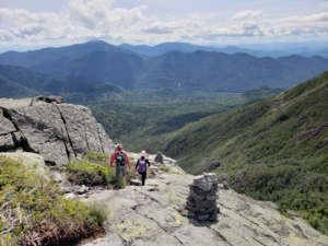
Saturday myself, Dexter, and our close friend Sean met at the Adirondack LOJ to finally climb MacNaughton, each of us having already completed the “46”. The next day Sean and I were to collect our certificates (Dexter having completed years ago), so it seemed fitting to undertake this climb. We met at the LOJ just after 7am and after adjusting our poles, packs, boots, zippers, and socks… we jaw-jacked. So we left around 7:20am, but that’s not too much later. Heck, we aimed for 6:30 originally! The weather was perfectly cool (Dexter donned gloves), albeit overcast. The bugs were non-existent, and although the parking lot was nearing capacity, we only saw 2 others behind us as we got to the register further down the trail.
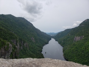
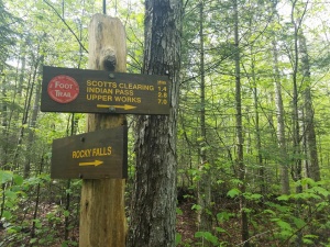 We made good time, hustling over the rocks on Indian Pass without incident while Sean kept us entertained with his stories… which I’m sure will eventually lead to a trail name befitting his gift for storytelling. It made the trail time go by quickly and easily no doubt, and we arrived at Scott’s Clearing in no time it seemed. Two lean-to residents told us they were heading to Wallface later, and we scooted across Indian Pass Brook toward the end of the marked trail. So far the trail was somewhat level and dry, but it was getting ready to change significantly.
The next 2.1 miles to Wallface Ponds was a steady, pretty easy climb but the amount of mud, deadfall, blowdown, and even snow significantly slowed us down. It’s an easy trail to follow, but at times there’s just no going around the deep mud (Note: try not to leave the trail. The impact on it is already noticeable).  We finally got to Wallface Ponds where we sat on a large boulder at water’s edge, eating a snack and prepping for our bushwack. I’d read we needed to steer toward the little hill to the southwest, but the best plans can get thrown out when you’re in the trees!
We had a map and we had our compass, had a couple trip reports, and had a fully charged Samsung Galaxy with a gps app on it to boot (more on this app at a later time). I’d plotted some waypoints earlier in the week and with the phone on airplane mode the whole way, had saved battery until we got to this point. Now it was a matter of following the arrow!
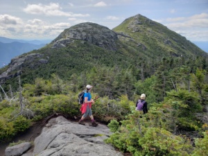
We headed off toward the pass between the ponds and quickly got into the woods further than we wanted. Like, really really into woods. It’s not that we were far off from where we needed to be, but the density of the woods really slowed us down and visibility was less than ideal. Finally finding the southern pond, we popped out of the wood line south of where the cairn marks the beginning of the bushwack. Grimm (from storytellers, Brother’s Grimm. Sean now has a trail name!) found the cairn and yelled us over, and from there we started our ascent. Heading somewhat kinda just about in the general direction of the peak, we made numerous adjustments to our path. We were yelling out “go more left!” or “we need to head right… a lot!”, and even sometimes “Stop! Where are you guys?” At times we could see what appeared to be a path, but staying on it proved impossible for us.
Remember: When you’re at the big rock at Wallface Ponds, look left along the shoreline. The cairn is just around that corner. If you stay close to the shoreline you’ll run right into it!
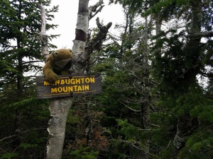
We were zeroing in on the summit, and our excitement was building. When we reached the marker on the gps we looked for the sign, and comparing it to the map thought for sure we were here. There’s a definitive trail on the summit, so Grimm led us westward until we finally found the sign. The beautiful, glorious end to our summit search! YESSSSS!
We took some photos and ate our lunch; plowing through so many Swedish Fish I thought I’d get sick. Of course Mother Nature had to weigh in on the length of our stay so it started sprinkling a little, prompting us to vacate our summit. We headed back the way we came sorta kinda not really. We’d walk a bit, make a course correction, then walk again trying to stay on our track from the ascent. It wasn’t easy that’s for sure! Pretty much similar to our morning, but eventually we reached a creek we had crossed earlier. Approaching it, we heard voices and stopped. Seriously? We’re on a bushwack, a few hundred feet from where we crossed in the morning, and here we are now face to face with a 5 people making their way through a bushwack, too! Then suddenly we hear “HEY! IS THAT DARCY???” Yup, we’re in the middle of nowhere and Dexter gets recognized from across the creek! They crossed to greet us and we talked a bit, took a few pics, and then they continued in the direction we had just come from. We crossed the creek and continued our wandering left and right until we finally found got back to Wallface Ponds. We were “out”! We continued a witty banter with Dexter, telling her how famous she was and how humbled we were to be hiking with such a legend of the Adirondacks! A great sport, Dexter took it in stride. Or was she plotting her revenge???
Now the real crap was ahead of us. Miles of mud, water, and now a few bugs. 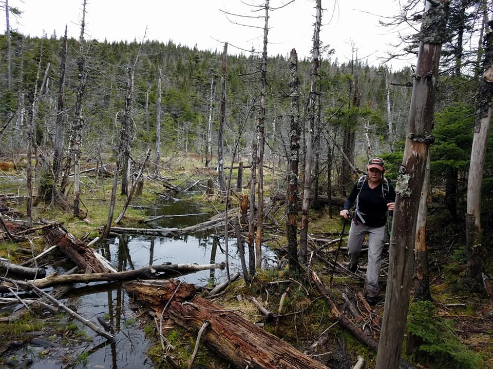 The trip out seemed to take forever, and Dexter’s Keene had a blowout of almost epic proportions. She was taking on water and mud, and on top of that the slick roots and rocks had us walking like we’d spent the entire night on a pub crawl. Almost the entire return on Indian Pass was spent in silence, spaced about 15 feet apart, just focused on getting back to our cars. Yeah, we were tired and covered in mud, ready to be done with MacNaughton. Granted, Indian Pass was again relatively dry and an easy walk out, but it being almost 6pm it was TIME TO GO.
We got to the parking lot about 6:15pm, almost exactly 11 hours after departing. Shoes were flung off, some more water chugged, and a few congratulatory hugs and high fives. Grimm met us in the upper lot and we sat around relaxing for a few minutes, of course still in awe we’d done MacNaughton with the legendary Dexter. Realizing we hadn’t eaten in awhile, we headed away toward a hot shower and hot food, saying in my best Chris Farley voice “Remember when we did MacNaughton? Um, yeah… that was awesome.”


As an aside, please remember to stay on the trails even with the mud. Going around increases trail erosion and degrades the soil quicker. And in order to keep MacNaughton as natural as possible, forego marking the trail with ribbons and such. The march of time will undoubtedly increase traffic to the summit, but we don’t have to help it. Keep it challenging and fun. It’s a great way to experience what it was like in the beginning (well, except the gps!)